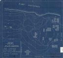
| Date: | 1905 |
|---|---|
| Description: | This blueprint map shows buildings and roads on Bascom Hill. University Avenue, Park street, Charter Street, and Lincoln Drive are labeled. Lake Mendota is... |

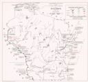
| Date: | 01 01 1959 |
|---|---|
| Description: | This map shows many of the rivers, dams, bays, harbors, lakes, and canals. It includes an index of authorized federal project, both for navigation and floo... |
If you didn't find the material you searched for, our Library Reference Staff can help.
Call our reference desk at 608-264-6535 or email us at: